
App Store Screenshots (10)

Design Analysis
Visual Design
App Insights
About GPS Map Camera
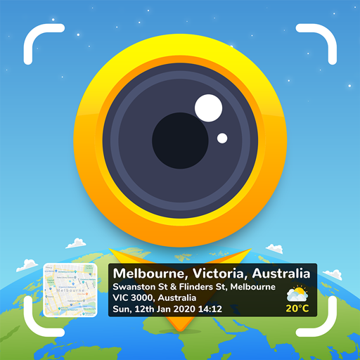
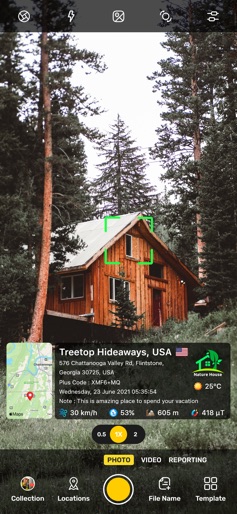
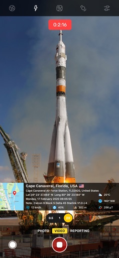
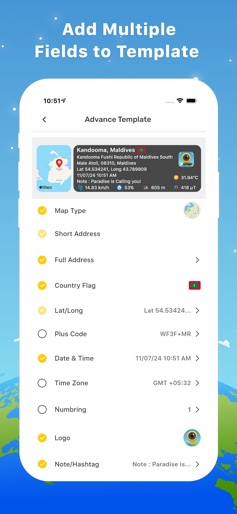
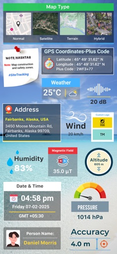
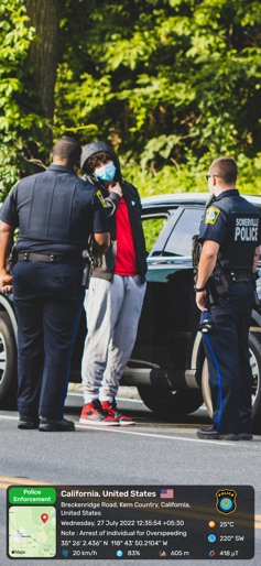
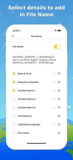
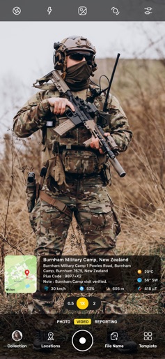
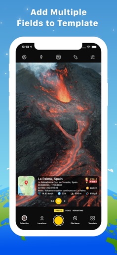
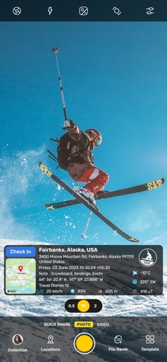
Add GPS Location stamp, Latitude Longitude stamp, Address stamp & Date TimeStamp with the help of GPS Map Camera App, also change different Style and Format of stamps Regardless of whether It's your moment recollections or your visit at a specific destination, with GPS Map camera stamp application, add & stamp Date, time, Map, Latitude, Longitude, Altitude, Weather, Magnetic field, Compass to Your Camera Photos. Track Live location along with your captured photos by GPS Map Camera: Geotag Photos Application. Send your Geo Location of Street / Place added photos to your Family & Friends, and let them know about your best earth travel memories and movements. How to add GPS map location on photos? ~ Install GPS Map Camera: Geotag Photos From App Store. ~ Select Advance or classic Templates, Arrange Formats of Stamps, Change Settings according to Your requirement of GPS map Location Stamp ~ Add GPS Location stamps automatically to your clicked pictures Interesting Features: ~ Get Custom GPS camera with Grid, Ratio, Front & Selfie camera, Flash, Focus, Mirror, Timer, capture sound Support ~ Set Map data as Automatic ~ Classic Template contains automatically fetched stamp details ~ In Advance Template Section: - Custom maps options: Change Map type from Normal, Satellite, Terrain, Hybrid Options - Address: Add your selected Automatic location on the Photo - Lat/Long: Set GPS Coordinates from DMS or Decimal Options for GPS Stamp - Date & Time: Add Date & Timestamp from various formats as an image tag. - Logo: Upload your own brand logo - Note: Write relatable Notes - Hashtags: You can also add hashtags related to your photos with this GPS app - Weather: Either in Fahrenheit or Celsius, Measure Temperature Units - Compass: Auto compass direction - Magnetic Field: Auto magnetic field Details - Wind: Measure Wind speed - Humidity: Auto Humidity measurement - Pressure: Measure pressure of the place - Altitude: It will automatically calculate Altitude - Accuracy: Get auto accuracy on image Why to have GPS Map Camera Application in Your Smartphone - To Add Satellite Map Stamp on Photos - To Add GPS Map Location Stamp to Photos - To Add Geotag Stamp on photos - To Add Photo Location stamp - To Add Date Timestamp - To Add Longitude, Latitude, Address, Date Time, Location stamp to Photos - To Check GPS tracker Stamp on Photos - To Get Geo Location image Stamp - Camera timestamp, having custom stamps for adding details manually Most Efficient Application For Following Groups of People: -Travelers & Explorers can effectively utilize Geo-tagging camera app - People who associated with business related to real estate, Infrastructure, Architecture can easily apply GPS Map Location stamp to their Site Photos - Individuals having Destination celebrations of events like Wedding, Birthdays, Festivals, Anniversaries, etc. Can have their current GPS location stamp on the picture. - Anyone who wants to add GPS Details on their photo as a GPS notecam can use the App. - Persons having outstation Meetings, conferences, Conclaves, Meetups, Events arranged by companies or Institutions solving and serving a particular purpose - Travel, Food, Fashion & Art Bloggers can advance their experiences by adding GPS Location through GPS Map Cam - Place Oriented businesses, where You require sending images with Live Location To Clients For experimenting with such Interesting Features, MUST Download GPS Map Camera: Geotag Photos Application Right now in your Smartphone. Do not forget to share your best experiences with us through Rate & Review.
Create screenshots like GPS Map Camera
Use FlyerBanana's free editor to create professional App Store screenshots inspired by GPS Map Camera's design. 100+ templates, device frames, and one-click export.
More Maps & Navigation Apps
View all

United Airlines
Maps & Navigation
Google Maps
Maps & Navigation


Southwest Airlines: Travel App
Maps & Navigation


The Weather Channel - Radar
Maps & Navigation
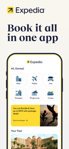

Expedia: Hotels, Flights, Cars
Maps & Navigation
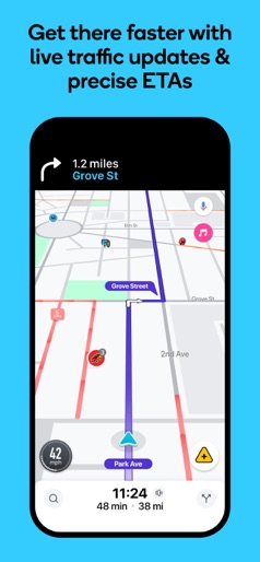

Waze Navigation & Live Traffic
Maps & Navigation